Laboratory for Sensing, Imaging, and Geomechanics Analysis
Laboratory for Sensing, Imaging, and Geomechanics Analysis
Home
News
Team
Projects
Publications
Blog
Openings
Contact
Light
Dark
Automatic
Geohazard
Risk Assessment and Management
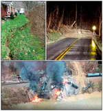
Turning geohazard science into decisions: regional landslide inventory and susceptibility mapping, rainfall-driven slope performance, and risk-informed management of transportation infrastructure.
Risk = Hazard $\times$ Vulnerability $\times$ Consequences
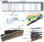
Mapping Fundamental‐Mode Site Periods and Amplifications from Thick Sediments: An Example from the Jackson Purchase Region of Western Kentucky, Central United States
VS30 is currently used as a key proxy to parameterize site response in engineering design and other applications. However, it has been …
Y Zhu
,
Z Wang
,
NS Carpenter
,
EW Woolery
,
WC Haneberg
Cite
Project
Project
DOI
Cite
×